.
NORTH CAROLINA WATERFALLS
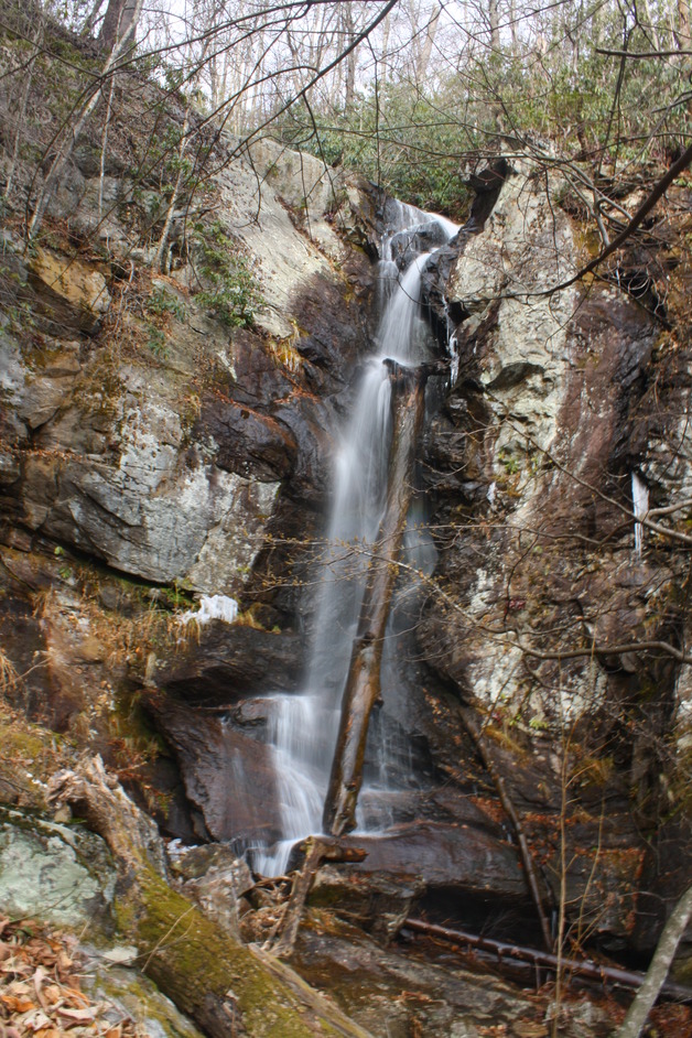
WATERFALL ON RIGHT FORK (5)
Driving Directions: From the junction of U.S. 64, U.S. 276, and N.C. 280, drive north on U.S. 276 for 5.1 miles to F.R. 475 on the left. Turn left and drive 3.8 miles to a parking area on the right and a gate for F.R. 137.
Hiking Directions: Hike down the orange blazed F.R. 137 to a fork at 0.12 mile. Go left. Heading right a short distance will take you to Tom Spring Falls. Continue another 0.35 mile to a trail to the left. Don’t take it. At 0.59 mile come to what appears to be the trail climbing the muddy bank. Go left and continue on the blazed trail, which uses a switchback to climb the slope and arrive at where you would have ended up if you climbed the bank. At 0.66 mile from the trailhead, come to another fork. Go right and continue another 0.4 mile to a small stream. Cross the stream. At 1.14 mile you will come to the river at a small waterfall. Scramble down the bank to see the falls. Continuing on the main trail, you will come to the remains of an old bridge at 1.25 miles. Continue following the blazed Daniel Ridge Trail upstream. At 1.28 mile from the trailhead, come to another small waterfall. Continue another 0.27 mile to what appears to be a fork. The trail to the left leads to a camp fire site. Go right and come to a campsite to the right at 1.63 mile. At 1.68 mile, reach the junction for the orange blazed Daniel Ridge Trail to the right and the blue blazed Farlow Gap Trail to the left. Go left on the Farlow Gap Trail heading upstream. Come to the creek in less than 0.2 mile from the trail junction. Cross the creek and follow a series of switchbacks. At 1.79 miles what appears to be a set of steps to the right. Continue on the trail to another set of steps on the left in another 0.1 mile. At these steps, head toward the creek and start bushwhacking upstream. At 1.85 mile from the trailhead, cross the creek. Once across the creek, it is 0.1 mile to another creek crossing, which is Lanning Branch. On Right Fork, a short distance from the confluence of Lanning Branch is a small sliding waterfall. After crossing Lanning Branch, climb the ridge to the left and continue to work your way upstream. The makeshift path follows the creek all the way to the falls. However, as you approach the falls, the right side becomes increasingly steep, therefore for a better view of the falls, cross the creek and work your way up the left side to the base of the falls.
Hiking Directions: Hike down the orange blazed F.R. 137 to a fork at 0.12 mile. Go left. Heading right a short distance will take you to Tom Spring Falls. Continue another 0.35 mile to a trail to the left. Don’t take it. At 0.59 mile come to what appears to be the trail climbing the muddy bank. Go left and continue on the blazed trail, which uses a switchback to climb the slope and arrive at where you would have ended up if you climbed the bank. At 0.66 mile from the trailhead, come to another fork. Go right and continue another 0.4 mile to a small stream. Cross the stream. At 1.14 mile you will come to the river at a small waterfall. Scramble down the bank to see the falls. Continuing on the main trail, you will come to the remains of an old bridge at 1.25 miles. Continue following the blazed Daniel Ridge Trail upstream. At 1.28 mile from the trailhead, come to another small waterfall. Continue another 0.27 mile to what appears to be a fork. The trail to the left leads to a camp fire site. Go right and come to a campsite to the right at 1.63 mile. At 1.68 mile, reach the junction for the orange blazed Daniel Ridge Trail to the right and the blue blazed Farlow Gap Trail to the left. Go left on the Farlow Gap Trail heading upstream. Come to the creek in less than 0.2 mile from the trail junction. Cross the creek and follow a series of switchbacks. At 1.79 miles what appears to be a set of steps to the right. Continue on the trail to another set of steps on the left in another 0.1 mile. At these steps, head toward the creek and start bushwhacking upstream. At 1.85 mile from the trailhead, cross the creek. Once across the creek, it is 0.1 mile to another creek crossing, which is Lanning Branch. On Right Fork, a short distance from the confluence of Lanning Branch is a small sliding waterfall. After crossing Lanning Branch, climb the ridge to the left and continue to work your way upstream. The makeshift path follows the creek all the way to the falls. However, as you approach the falls, the right side becomes increasingly steep, therefore for a better view of the falls, cross the creek and work your way up the left side to the base of the falls.